 DataSuds-geo
La colonisation des plaines par les montagnards au nord du Cameroun (Monts Mandara). Scale of 1:300 000 to 1:13 300. Date of publication: 1971-1974.
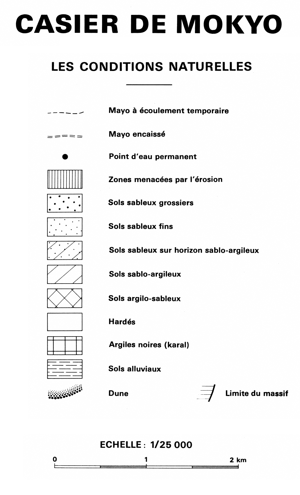
1. Casier de Mokyo : les conditions naturelles : carte n° 8. / Boutrais, Jean; Danard, M. (ill.); Scale of 1:25 000. Date of publication: 1972. (file: 01156RC_IRD_CMR_EVPH_1972_25000_IRD_CMR_CSRE_1971-74_300000-13300.tif)
2. Casier de Mokyo : mise en place récente des populations entre les mayos ranéo et mangafé carte n° 6. / Boutrais, Jean; Danard, M. (ill.); Scale of 1:25 000. Date of publication: 1972. (file: 01154RC_IRD_CMR_POPU_1972_25000_IRD_CMR_CSRE_1971-74_300000-13300.tif)
3. Casier de Mokyo : variations des espaces cultivés entre les mayos mangafé et ranéo : carte n° 7. / Boutrais, Jean; Danard, M. (ill.); Scale of 1:25 000. Date of publication: 1972. (file: 01155RC_IRD_CMR_AGCU_1972_25000_IRD_CMR_CSRE_1971-74_300000-13300.tif)
4. La colonisation de la plaine de Koza : carte n° 2. / Boutrais, Jean; Danard, M. (ill.); Scale of 1:50 000. Date of publication: 1974. (file: 01150RC_IRD_CMR_POPE_1974_50000_IRD_CMR_CSRE_1971-74_300000-13300.tif)
5. La colonisation des plaines de Mora et du Diamaré : carte n° 3. / Boutrais, Jean; Alboucq, G. (ill.); Danard, M. (ill.); Scale of 1:200 000. Date of publication: 1972. (file: 01151RC_IRD_CMR_POPE_1972_200000_IRD_CMR_CSRE_1971-74_300000-13300.tif)
6. Le casier de colonisation de Mokyo : carte n° 9 : d'après un levé de terrain en 1968. / Boutrais, Jean; Alboucq, G. (ill.); Scale of 1:13 300. Date of publication: 1971. (file: 01157RC_IRD_CMR_TOPO_1971_13300_IRD_CMR_CSRE_1971-74_300000-13300.tif)
7. Le plateau au sud de Mokolo : carte n° 4. / Boutrais, Jean; Danard, M. (ill.); Scale of 1:20 000. Date of publication: 1973. (file: 01152RC_IRD_CMR_EVPH_1973_20000_IRD_CMR_CSRE_1971-74_300000-13300.tif)
8. Les massifs Oupay-Moudoukoua : carte n° 11. / Boutrais, Jean; Danard, M. (ill.); Scale of 1:20 000. Date of publication: 1974. (file: 01159RC_IRD_CMR_EVPH_1974_20000_IRD_CMR_CSRE_1971-74_300000-13300.tif)
9. Périmètre de Doulo-Ganay : carte n° 10. / Boutrais, Jean; Danard, M. (ill.); Scale of 1:20 000. Date of publication: 1974. (file: 01158RC_IRD_CMR_EVPH_1974_20000_IRD_CMR_CSRE_1971-74_300000-13300.tif)
10. Plaine de Mozogo : carte n° 5. / Boutrais, Jean; Danard, M. (ill.); Scale of 1:20 000. Date of publication: 1973. (file: 01153RC_IRD_CMR_EVPH_1973_20000_IRD_CMR_CSRE_1971-74_300000-13300.tif)
11. Répartition de la population au nord des monts Mandara : carte n° 1. / Boutrais, Jean; Alboucq, G. (ill.); Scale of 1:300 000. Date of publication: 1972. (file: 01149RC_IRD_CMR_PODE_1972_300000_IRD_CMR_CSRE_1971-74_300000-13300.tif)
Simple
- Date (Publication)
- 1971-01-01
- Citation identifier
- IRD_CMR_CSRE_1971-74_300000-13300
- Credit
-
The region Île-de-France, under the project NumeriSud, supported the action to transforme around 2800 maps that are conserved at the Institut de recherche pour le développement (IRD) library in Bondy into a standard coordinate system. The transformation of the images has been done by Global Mapping Resources (South Africa) under the supervision of R. Zaiss (éditeur) 2014.
- Status
- Completed
- Point of contact
-
Organisation name Individual name Electronic mail address Role Institut de recherche pour le développement (IRD)
Production cartographique IRD
Point of contact Boutrais, Jean
Author Alboucq, G. (ill.)
Author Danard, M. (ill.)
Author ORSTOM, Office de la recherche scientifique et technique outre-mer
editor
- Maintenance and update frequency
- Not planned
- Vocabulaire multidisciplinaire de Horizon
-
- Agriculture
- Arachide
- Arbre
- Arbre fruitier
- Canne a sucre
- Casier
- Colonisation agricole
- Coton
- Culture
- Densité de population
- Dynamique de population
- Éleveur
- Ethnie
- Groupe ethnique
- Histoire du peuplement
- Migration
- Mil
- Mode d'occupation du sol
- Occupation spatiale
- Parc
- Plante cultivée
- Plante utile
- Population
- Répartition
- Savane arbustive
- Savane boisée
- Sol
- Sorgho
- Superficie cultivée
- Terroir
- Transfert de population
- Utilisation du sol
-
Geounits
-
-
Africa
-
Middle Africa
-
Cameroon
-
- Theme
-
-
settlements
-
topography
-
thematic map
-
- Keywords
-
-
project NumeriSud
-
map collection
-
local coverage
-
- Use limitation
-
Licence : CC-BY-NC-SA
- Access constraints
- licence
- Classification
- Unclassified
- Spatial representation type
- Grid
- Denominator
- 13300
- Language
- Français
- Character set
- UTF8
- Topic category
-
- Elevation
- Farming
- Geoscientific information
- Imagery base maps earth cover
- Planning cadastre
- Society
))
))
))
))
- Begin date
- 1971-01-01
- End date
- 1974-12-31
- Supplemental Information
-
Publication(s):
Boutrais, J. (1971-1974): La colonisation des plaines par les montagnards au nord du Cameroun (Monts Mandara). Paris (FRA) : ORSTOM, Office de la recherche scientifique et technique outre mer.
- Reference system identifier
- EPSG / 4326 / 7.9
- Distribution format
-
Name Version GeoTIFF
1.0
- Distributor contact
-
Organisation name Individual name Electronic mail address Role DataSuds-geo
Publisher
- OnLine resource
-
Protocol Linkage Name OGC:WMS
https://datasuds-geo.ird.fr/geoserver/wms sphaera_ws:01156RC_IRD_CMR_EVPH_1972_25000_IRD_CMR_CSRE_1971-74_300000-13300
WWW:DOWNLOAD:GeoTIFF https://datasuds-geo.ird.fr/geoserver/ows?service=WCS&version=2.0.1&request=GetCoverage&coverageId=01156RC_IRD_CMR_EVPH_1972_25000_IRD_CMR_CSRE_1971-74_300000-13300 WWW:LINK-1.0-http--related
https://www.documentation.ird.fr/hor/fdi:02530 Notice explicative ou autre ouvrage
- OnLine resource
-
Protocol Linkage Name OGC:WMS
https://datasuds-geo.ird.fr/geoserver/wms sphaera_ws:01154RC_IRD_CMR_POPU_1972_25000_IRD_CMR_CSRE_1971-74_300000-13300
WWW:DOWNLOAD:GeoTIFF https://datasuds-geo.ird.fr/geoserver/ows?service=WCS&version=2.0.1&request=GetCoverage&coverageId=01154RC_IRD_CMR_POPU_1972_25000_IRD_CMR_CSRE_1971-74_300000-13300 WWW:LINK-1.0-http--related
https://www.documentation.ird.fr/hor/fdi:02530 Notice explicative ou autre ouvrage
- OnLine resource
-
Protocol Linkage Name OGC:WMS
https://datasuds-geo.ird.fr/geoserver/wms sphaera_ws:01155RC_IRD_CMR_AGCU_1972_25000_IRD_CMR_CSRE_1971-74_300000-13300
WWW:DOWNLOAD:GeoTIFF https://datasuds-geo.ird.fr/geoserver/ows?service=WCS&version=2.0.1&request=GetCoverage&coverageId=01155RC_IRD_CMR_AGCU_1972_25000_IRD_CMR_CSRE_1971-74_300000-13300 WWW:LINK-1.0-http--related
https://www.documentation.ird.fr/hor/fdi:02530 Notice explicative ou autre ouvrage
- OnLine resource
-
Protocol Linkage Name OGC:WMS
https://datasuds-geo.ird.fr/geoserver/wms sphaera_ws:01150RC_IRD_CMR_POPE_1974_50000_IRD_CMR_CSRE_1971-74_300000-13300
WWW:DOWNLOAD:GeoTIFF https://datasuds-geo.ird.fr/geoserver/ows?service=WCS&version=2.0.1&request=GetCoverage&coverageId=01150RC_IRD_CMR_POPE_1974_50000_IRD_CMR_CSRE_1971-74_300000-13300 WWW:LINK-1.0-http--related
https://www.documentation.ird.fr/hor/fdi:02530 Notice explicative ou autre ouvrage
- OnLine resource
-
Protocol Linkage Name OGC:WMS
https://datasuds-geo.ird.fr/geoserver/wms sphaera_ws:01151RC_IRD_CMR_POPE_1972_200000_IRD_CMR_CSRE_1971-74_300000-13300
WWW:DOWNLOAD:GeoTIFF https://datasuds-geo.ird.fr/geoserver/ows?service=WCS&version=2.0.1&request=GetCoverage&coverageId=01151RC_IRD_CMR_POPE_1972_200000_IRD_CMR_CSRE_1971-74_300000-13300 WWW:LINK-1.0-http--related
https://www.documentation.ird.fr/hor/fdi:02530 Notice explicative ou autre ouvrage
- OnLine resource
-
Protocol Linkage Name OGC:WMS
https://datasuds-geo.ird.fr/geoserver/wms sphaera_ws:01157RC_IRD_CMR_TOPO_1971_13300_IRD_CMR_CSRE_1971-74_300000-13300
WWW:DOWNLOAD:GeoTIFF https://datasuds-geo.ird.fr/geoserver/ows?service=WCS&version=2.0.1&request=GetCoverage&coverageId=01157RC_IRD_CMR_TOPO_1971_13300_IRD_CMR_CSRE_1971-74_300000-13300 WWW:LINK-1.0-http--related
https://www.documentation.ird.fr/hor/fdi:02530 Notice explicative ou autre ouvrage
- OnLine resource
-
Protocol Linkage Name OGC:WMS
https://datasuds-geo.ird.fr/geoserver/wms sphaera_ws:01152RC_IRD_CMR_EVPH_1973_20000_IRD_CMR_CSRE_1971-74_300000-13300
WWW:DOWNLOAD:GeoTIFF https://datasuds-geo.ird.fr/geoserver/ows?service=WCS&version=2.0.1&request=GetCoverage&coverageId=01152RC_IRD_CMR_EVPH_1973_20000_IRD_CMR_CSRE_1971-74_300000-13300 WWW:LINK-1.0-http--related
https://www.documentation.ird.fr/hor/fdi:02530 Notice explicative ou autre ouvrage
- OnLine resource
-
Protocol Linkage Name OGC:WMS
https://datasuds-geo.ird.fr/geoserver/wms sphaera_ws:01159RC_IRD_CMR_EVPH_1974_20000_IRD_CMR_CSRE_1971-74_300000-13300
WWW:DOWNLOAD:GeoTIFF https://datasuds-geo.ird.fr/geoserver/ows?service=WCS&version=2.0.1&request=GetCoverage&coverageId=01159RC_IRD_CMR_EVPH_1974_20000_IRD_CMR_CSRE_1971-74_300000-13300 WWW:LINK-1.0-http--related
https://www.documentation.ird.fr/hor/fdi:02530 Notice explicative ou autre ouvrage
- OnLine resource
-
Protocol Linkage Name OGC:WMS
https://datasuds-geo.ird.fr/geoserver/wms sphaera_ws:01158RC_IRD_CMR_EVPH_1974_20000_IRD_CMR_CSRE_1971-74_300000-13300
WWW:DOWNLOAD:GeoTIFF https://datasuds-geo.ird.fr/geoserver/ows?service=WCS&version=2.0.1&request=GetCoverage&coverageId=01158RC_IRD_CMR_EVPH_1974_20000_IRD_CMR_CSRE_1971-74_300000-13300 WWW:LINK-1.0-http--related
https://www.documentation.ird.fr/hor/fdi:02530 Notice explicative ou autre ouvrage
- OnLine resource
-
Protocol Linkage Name OGC:WMS
https://datasuds-geo.ird.fr/geoserver/wms sphaera_ws:01153RC_IRD_CMR_EVPH_1973_20000_IRD_CMR_CSRE_1971-74_300000-13300
WWW:DOWNLOAD:GeoTIFF https://datasuds-geo.ird.fr/geoserver/ows?service=WCS&version=2.0.1&request=GetCoverage&coverageId=01153RC_IRD_CMR_EVPH_1973_20000_IRD_CMR_CSRE_1971-74_300000-13300 WWW:LINK-1.0-http--related
https://www.documentation.ird.fr/hor/fdi:02530 Notice explicative ou autre ouvrage
- OnLine resource
-
Protocol Linkage Name OGC:WMS
https://datasuds-geo.ird.fr/geoserver/wms sphaera_ws:01149RC_IRD_CMR_PODE_1972_300000_IRD_CMR_CSRE_1971-74_300000-13300
WWW:DOWNLOAD:GeoTIFF https://datasuds-geo.ird.fr/geoserver/ows?service=WCS&version=2.0.1&request=GetCoverage&coverageId=01149RC_IRD_CMR_PODE_1972_300000_IRD_CMR_CSRE_1971-74_300000-13300 WWW:LINK-1.0-http--related
https://www.documentation.ird.fr/hor/fdi:02530 Notice explicative ou autre ouvrage
- OnLine resource
-
Protocol Linkage Name DOI
https://doi.org/10.23708/8d0ecb06-5faa-409d-ae33-9420d75d2a54 Digital Object Identifier (DOI)
- Hierarchy level
- Dataset
- Statement
-
1. Scanning to tif format, 256 colors, 250dpi.
2. Georeferencing and if possible reprojection to WGS84 (Longitude / Latitude).
3. Clipping and mosaicing of map sheets(s).
4. Export ECW format.
5. ECW to GeoTIFF format conversion.
Metadata
- File identifier
- 8d0ecb06-5faa-409d-ae33-9420d75d2a54 XML
- Metadata language
- English
- Character set
- UTF8
- Hierarchy level
- Dataset
- Hierarchy level name
-
dataset
- Date stamp
- 2024-02-13T18:36:37.505185Z
- Metadata standard name
-
ISO 19115:2003/19139
- Metadata standard version
-
1.0
- Metadata author
-
Organisation name Individual name Electronic mail address Role Institut de recherche pour le développement (IRD)
Service de l'Information Scientifique et Technique (IST) IRD
Point of contact Institut de recherche pour le développement (IRD)
IRD
Resource provider
Overviews


Spatial extent
Provided by
